
Lafayette to Buena Vista
The day finally arrived to leave on my trip to Santa Fe!
I left Lafayette the morning of September 13 to ride to my mom’s in Buena Vista. The early fall weather was pleasant and warm.
The traffic wasn’t bad as I was traveling on a week day and I made good time down to Golden and up Turkey Creek Canyon on Highway 285.
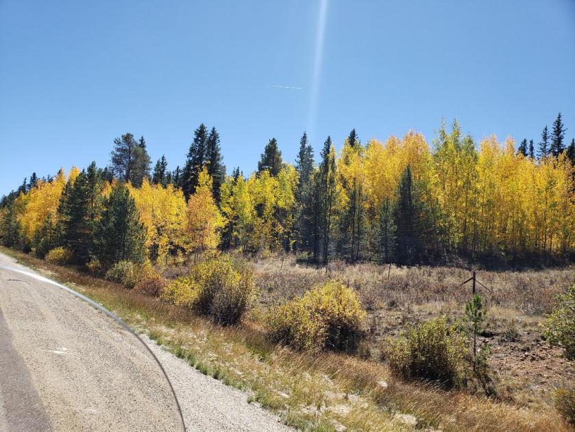
Fall colors had hit the high country and I stopped briefly near the top of Kenosha Pass to capture these golden aspens:
Buena Vista to Taos
On Friday the 14th, I left about 9:00, heading south out of Buena Vista. I made my way up Poncha Pass and continued down Highway 285.
This stretch of highway is fairly flat, with yellow and purple wildflowers near the shoulder. Sagebrush and other scrub extends off to the east to the foothills of the Sangre de Cristo mountain range. Far to the south, the mountains were nearly obscured by haze.
South of Villa Grove, I kept straight at the junction with Highway 17, to continue south on this road which leads into the heart of the San Luis Valley.
Highway 17 continues arrow-straight all the way to Alamosa. As I made my way south, I could just make out the light-colored smudge on the dark foothills to the south – the Great Sand Dunes.
My original intent was to stop at the UFO Watchtower in Hooper. However, I didn’t notice direction signs to it when I rode through town, so I continued riding. I saw signs for the Sand Dunes public pool and for the Colorado Gators Reptile Park. There are quite a few things to see and do in the San Luis Valley besides look for UFOs and go to the Sand Dunes!
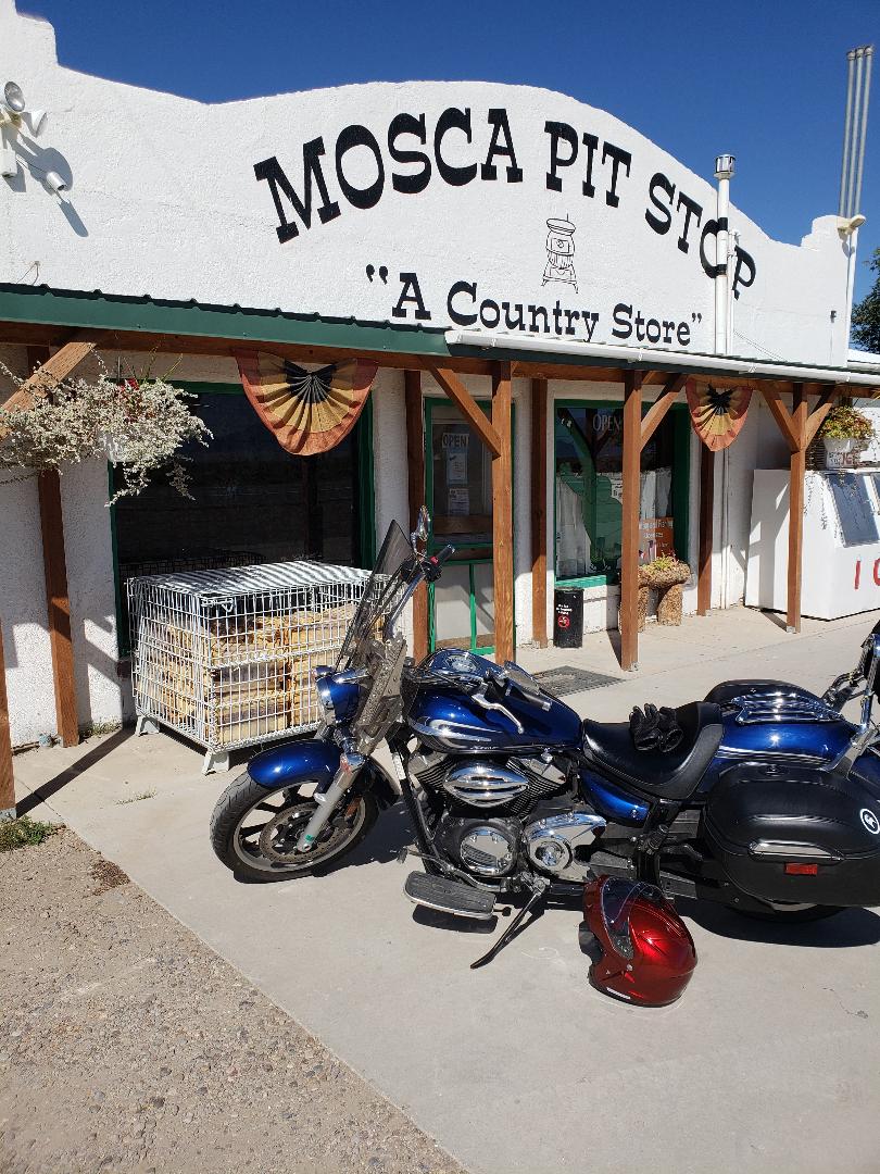
I stopped in Mosca, a few miles further down the road:
From there, I went on to Alamosa, where I got confused. As I entered town, I saw a sign pointing east to Walsenburg. I thought “I don’t want to go to Walsenburg,” so went south through town and headed east on a two-lane road. Well, I started getting that now-familiar nagging feeling I was on the wrong road. There was no traffic, with farmland on both sides. I stopped and checked my location, and I was southeast of Alamosa on a highway that would take me to a wildlife refuge. Luckily, I had only gone about 3 miles the wrong way. I made a slow U-turn in the middle of the road and went back into town.
I found that I did indeed need to take the highway to Walsenburg – Highway 160 going east.
I was relieved to on the right highway, and enjoyed the panorama before me as I drew closer to Blanca Peak. However, I had not yet gassed up since I left Buena Vista, and wondered if I should have topped off the tank in Alamosa, which is 100 miles from Buena Vista. This concern put a bit of a damper on my enjoyment of the scenery.
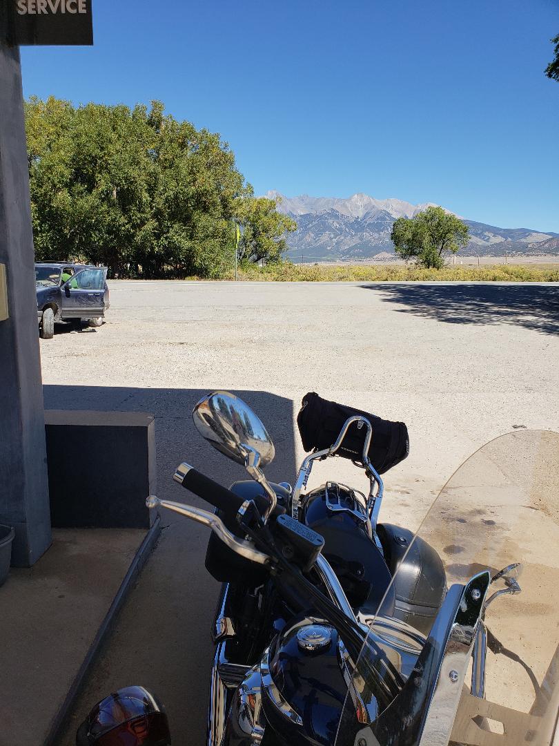
Finally, I found a gas station in Blanca, having gone about 120 miles. I found there was nothing to worry about, as the bike was getting over 50 miles a gallon!
Here’s the bike at the station with Blanca Peak in the distance:
From Blanca, I continued east to Fort Garland, turning south on Highway 159, where I was delighted to see a sign for Taos!
Passing through the small town of San Luis, I headed for the border.
I had toyed with the idea of stopping at the state line for a “Kodak moment” with the sign welcoming me to New Mexico. But, there were people already stopped there, so I kept riding.
(Highway 159 in Colorado becomes Highway 522 in New Mexico – and the speed limit lowers from 65 mph to 60 mph. . .)
The terrain and vegetation changed from flat and scrubby to hilly and more wooded as I made my way to Taos. Part of the highway here has a rolling series of hills, like a roller coaster, with pine trees on both sides.
Finally, I arrived in town and got off the bike for an extended break for lunch, eating at the Bent Street Deli. I certainly knew I was in New Mexico, as Taos has an abundance of adobe architecture. As much as I wanted to linger and take in the sights, I had another 70 miles to go so I hopped back on the bike.
Taos to Santa Fe
The route I had chosen from Taos was down Highway 68, which follows the Rio Grande southwest. I later learned this is called the “Low Road.” The “High Road” takes Highway 518 south from Taos on a twisty scenic route. I will do that one next time!
I had views of the Rio Grande for a good bit of the ride towards Española, and got to see some people in rafts enjoying the warm fall day. The highway through Española was not pleasant. When you are on a motorcycle, you are much more aware of road surfaces than when you are in a car. About every 12 feet, there was a crack going across the lane – b-boom…b-boom…b-boom… I was eager to get to Santa Fe and off the road!
Finally, I made it to Santa Fe and kept my eyes peeled for the intersection with Paseo de Peralta, where I needed to turn left to get to the casita where I was staying.
I approached a major intersection and wondered if that was it – and sailed through it before realizing that was my turn. I made a U-turn and got on that road, turned the corner, and I was on San Francisco Street, and my casita was on Elena, just four blocks down on the left.
And there it was! I made my way down the street, found the right house number and . . . gravel!
I had seen the parking area on Google street view and knew that it was a gravel surface. The gravel is less than an inch in diameter and is probably 2 inches deep in places. Not an ideal surface for maneuvering a motorcycle!
But, although I was tired after riding 300 miles, I just slowly moved my bike into the designated parking space at the back, put the kickstand down, and dismounted. Whew. I was not looking forward to backing out in this gravel!
Next post: Touring Santa Fe and how I do getting out of the gravel!
